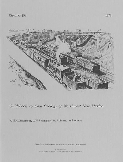
Circular 154—Guidebook to coal geology of northwest New Mexico
By E. C. Beaumont, J. W. Shomaker, W. J. Stone, and others, 1976, 58 pp., 2 tables, 49 figs., 1 sheet.

Contains geologic road logs for a three-day field trip on the coal resources of northwestern New Mexico. Also contains three short technical papers pertaining to subject. The San Juan Basin is a structural depression at the edge of the Colorado Plateau. The basin has about 6,000 ft of structural relief and covers about 10,000 mi2 of northwestern New Mexico and southeastern Colorado. Monoclines are the most distinct structures in the Colorado Plateau; excellent examples occur in the San Juan Basin, the most prominent being the north-south-trending Hogback Mountain, near the west edge of the basin. Over 14,000 ft of sedimentary rocks occur in the deepest part of the basin, as indicated in a well drilled to basement near Gobernador in northwestern Rio Arriba County.
Jurassic and older rocks mark the perimeter of the basin. Within the basin, broad bands of Cretaceous and younger rock units crop out. The Cretaceous-Tertiary boundary occurs within the Ojo Alamo Sandstone. The central and eastern areas are covered by rocks of Tertiary age. Quaternary deposits occur in stream valleys, in terraces, along mountain fronts, and atop all other rock units. The general stratigraphic succession in the San Juan Basin is shown in the chart presented inside the back cover. The uranium-bearing Jurassic rocks are believed to record nonmarine or continental deposition extending northward from highlands in the south. The Cretaceous portion of the sedimentary record of the basin is summarized in the cross section. The coal-bearing strata are believed to represent deposition in, and at the margins of, the vast Cretaceous seaway that extended across the continent from the Arctic Ocean to the Gulf of Mexico about 135 million years ago. As this sea lapped on and off the land, a unique record of alternating carbonaceous shales and coals of coastal plain origin, marine shoreline sandstones, and marine offshore shales was produced. Nonmarine conditions were restored after the sea retreated at the end of Cretaceous time resulting in the Tertiary continental deposits in the central basin.
In physiographic terms, the San Juan Basin is situated in the Navajo section of the Colorado Plateau and is characterized by broad open valleys, mesas, buttes, and hogbacks. Away from major valleys and canyons topographic relief is generally low. Native vegetation is sparse and shrubby. Drainage is mainly by the San Juan River, the only permanent stream in the Navajo Section of the Colorado Plateau; the San Juan River is a tributary of the Colorado River. Between the inflow point in Rio Arriba County and outflow point in San Juan County, the San Juan drops about 1,800 ft in elevation. Major tributaries include the Animas, Chaco, and La Plata Rivers. Average annual discharges reported for the period 1913–1951 are: 729,400 acre-ft for the Animas at Farmington; 1,179,400 acre-ft for the San Juan near Blanco; and 2,194,800 acre-ft for the San Juan at Shiprock. Flow of the San Juan River across the basin is regulated by the Navajo Dam, located about 30 mi northeast of Farmington. The climate is arid to semiarid with an average annual precipitation of 8–10 in. The annual pan evaporation rate, based on records for the period 1948–1962, is 67 in. The average January temperature is 28ºF; the average July temperature is 73ºF.
Coal occurs throughout the Cretaceous section of the basin. In New Mexico
important deposits are largely restricted to the Mesaverde Group and the
Fruitland Formation. The Mesaverde Group includes, in ascending order, the
Gallup Sandstone, the Crevasse Canyon Formation, the Point Lookout Sandstone,
the Menefee Formation, and the Cliff House Sandstone. Only the Crevasse
Canyon and Menefee Formations are significantly coal bearing. Minor coal
occurs in the Gallup and Dakota Sandstones. Strippable reserves approach
6 billion tons. The largest portion of this coal is associated with Fruitland
Formation. Nearly equal reserves occur in the overburden categories of 10–150
ft and 150–250 ft. Reserves of deep coal, defined as that beneath more
than 250 ft of overburden, are even larger. The Fruitland alone is estimated
to contain about 154 billion tons of deep coal-about 30 times the strippable
reserves. The Menefee Formation contains another 115 billion tons of deep
coal.
$8.50
Buy
Now
Also available as a free download.
Download
| File Name | Size | Last Modified |
|---|---|---|
| Circular-154.pdf | 2.12 MB | 01/11/2021 03:11:07 PM |


