


Featured Products
We are a research and service division of:
The New Mexico Bureau of Geology and Mineral Resources has published geoscience research and information since its inception in 1927. The bookstore at our main office on the campus of New Mexico Tech in Socorro sells our publications as well as publications from NMGS, USGS, and many other publishers. Our bookstore is accross the hall from our Mineral Museum, which is well worth a visit.
Below is a selection of popular featured products that we currently have available:
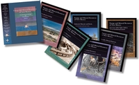
Memoir-50 — Energy and Mineral Resources of New Mexico: Boxed Set
— see individual volumes, 2017
This boxed set of six volumes provides the most comprehensive and extensive review of New Mexico’s energy and mineral resources to-date. Each volume focuses on the geologic nature of the resource, the history of the resource development in New Mexico, and their importance to the world and New Mexico’s economy. Written by New Mexico’s own experts in the fields, this set covers energy resources of petroleum, natural gas, coal, uranium, and geothermal, along with the resources of metals and industrial minerals and rocks.
This memoir is published jointly by the New Mexico Bureau of Geology & Mineral Resources and the New Mexico Geological Society.
Energy and Mineral Resources of New Mexico, NMBGMR, Memoir 50 and NMGS Special Publication 13 (six-volume boxed set)
A: Petroleum Geology — Ronald F. Broadhead
B: Coal Resources — Gretchen K. Hoffman
C: Uranium Resources — Virginia T. McLemore and William L. Chenoweth
D: Metallic Mineral Deposits — Virginia T. McLemore and Virgil W. Lueth
E: Industrial Minerals and Rocks — Virginia T. McLemore and George S. Austin
F: Overview of the Valles Caldera (Baca) Geothermal System — Fraser Goff and Cathy J. Goff
564 pages
ISBN: 978-1-883905-43-9
$125.00
Buy
Now
more details...
Boxed set, Volumes A-F
Also available as a free download.
Geologic Road Log: Cumbres & Toltec Scenic Railroad
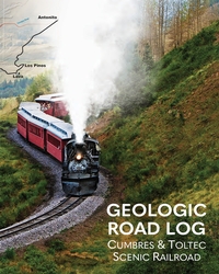
— Shari Kelly, Peter Barkmann, Rob Benson, Jonathan Lovekin, and Lisa Dunn, 2023
This geologic road log describes the diverse geology exposed along the Cumbres & Toltec Scenic Railroad between Antonito, Colorado, and Chama, New Mexico. The booklet was designed for use on the annual "Geotrain" excursion offered by the Cumbres & Toltec Scenic Railroad each summer since 2011. The geologic journey begins in the San Luis Basin in the Rio Grande rift, traverses the southern San Juan volcanic field, and ends in the Chama Basin. The booklet includes a brief introduction to the regional geology of the area, a discussion of the engineering geology associated with building and maintaining the railroad, and descriptions of outcrops exposed in roadcuts along the rail line.
36 pages
ISBN: 978-1-883905-51-4
$9.00
Buy
Now
more details...
Geology of Northern New Mexico's Parks, Monuments, and Public Lands
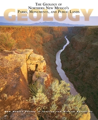
— L. Greer Price, [ed.], 2010
Few places in the U.S. boast as rich a diversity of landscape and public lands as northern New Mexico. Here in one volume is an authoritative overview of the geology of these parks, monuments, and public lands, with information on the regional setting, the rock record, and the most prominent geologic features. The book includes chapters on nine national parks and monuments, seventeen state parks, and many of the most popular Bureau of Land Management and U.S. Forest Service units in this part of the state. Also included are chapters on two of our newer units, the Valles Caldera National Preserve and Kashe-Katuwe Tent Rocks National Monument. With nearly 300 full-color geologic maps, graphics, and photographs, the book is a perfect introduction to the some of New Mexico's most significant geologic landscapes.
Free sample chapter—Ghost Ranch (4 MB PDF)
372 pages
ISBN: 9781883905255
$29.95
Buy
Now
more details...
Third revised reprinting
Resource Map-24 — Mining Districts and Prospect Areas in New Mexico
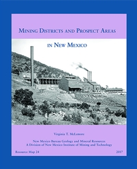
— Virginia T. McLemore, 2017
This Resource Map locates and describes 246 mining areas in New Mexico (excluding coal fields). The included booklet begins with a brief description of the history of mining in New Mexico and is followed by discussions of previous work, mining claims, the definition of a mining district, mining methods, and classification of mineral deposits. Short descriptions of individual mining districts and prospect areas in New Mexico are in Appendix 1. Appendix 2 includes metal production from selected districts. Appendix 3 is a summary of previous mining districts maps. This report updates File and Northrop (1966), Howard (1967), and Mardirosian (1971), the last comprehensive summaries of all mining districts in New Mexico.
65 pages, One map sheet: 24" x 28"
Supplemental data: Repository-20170001
ISBN: 9781883905361
https://doi.org/10.58799/RM-24
$18.95
Buy
Now
more details...
Also available as a free download.
Geologic Map-80 — Geologic Map of Mount Taylor Volcano Area, New Mexico
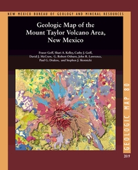
— Fraser Goff, Shari A. Kelley, Cathy J. Goff, David J. McCraw, G. Robert Osburn, John R. Lawrence, Paul G. Drakos, and Steven J. Skotnicki, 2019
The Geologic Map of the Mount Taylor Volcano Area, New Mexico is a 1:36,000 compilation of six recent NMBGMR 1:24,000 geologic quadrangles that encompass this extinct composite stratovolcano. Mount Taylor is New Mexico’s second-largest volcano after the Valles Caldera in the Jemez Mountains. This timely map and accompanying report, resulting from over a decade of thorough work, synthesizes the current geologic understanding of such an important landscape feature of the state.
For such a complex volcanic landform, the report provides an exhaustive description of the volcano area in an easy-to-read format. In addition to providing a detailed description of each of the map’s 339 units and dikes, it documents the volcano’s history and history of research, its geochemical and petrographic composition, the phases of its construction ranging from the initial to the terminal eruptions, 3.72–1.26 million years ago, and its subsequent erosion, resulting in the summit Amphitheater and its extensive apron of debris. It describes the surrounding volcanic centers, the structure of the area, and the extensive dikes and maars. After touching on the water resources, hydrothermal alteration and mineralization, and geothermal potential, the report concludes with a conceptual model of volcano evolution.
Available folded or rolled on field-durable media. There is also a puzzle version of this geologic map.
66 pages
ISBN: 978-1-883905-44-6
https://doi.org/10.58799/GM-80
$24.95
Buy
Now
more details...
One 62" x 44" folded sheet + 66 page booklet
Bulletin-164 — Climate Change in New Mexico Over the Next 50 Years: Impacts on Water Resources
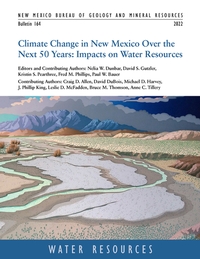
— N.W. Dunbar, D.S. Gutzler, K.S. Pearthree, F.M. Phillips, P.W. Bauer, C.D. Allen, D. DuBois, M.D. Harvey, J.P. King, L.D. McFadden, B.M. Thomson, and A.C. Tillery, 2022
Earth is warming in response to increasing atmospheric carbon dioxide. Global climate models project an average temperature increase across New Mexico of 5° to 7° F over the next 50 years. Other primary impacts are decreased water supply (partly driven by thinner snowpacks and earlier spring melting), lower soil moisture levels, increased frequency and intensity of wildfires, and increased competition and demand for scarce water resources. Snowpack and associated runoff are projected to decline substantially over the next 50 years, generating diminished headwater streamflow. Flow in the state's major rivers is projected to decline by 16% to 28%, and the frequency of extreme precipitation events, coupled with fire-driven disruption of vegetation in watersheds, is projected to at least double river sediment. The impacts of climate change on New Mexico's water resources are overwhelmingly negative.
The bulletin, which is the scientific foundation upon which New Mexico's 50-Year Water Plan is based, represents a compilation, assessment and integration of existing peer-reviewed published research, technical reports and datasets relevant to the broad topic of changes to New Mexico climate over the next 50 years, and resultant impact on water resources. This project, also known as the "Leap Ahead" analysis, also identifies significant data and modeling gaps and uncertainties, and suggests research directions to strengthen our understanding of climate and water resource changes
218 pages
https://doi.org/10.58799/B-164
$10.00
Buy
Now
more details...
Also available as a free download.
Satellite mug
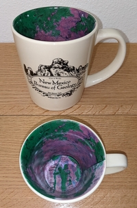
The interior of this mug has a reproduction of our Resource Map-23: Satellite Image of New Mexico. The front of the mug says "New Mexic Bureau of Geology" with a graphic depicting City of Rocks State Park near Deming, New Mexico.
$14.99
Buy
Now
The Rio Grande: A River Guide to the Geology and Landscapes of Northern New Mexico
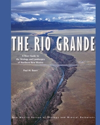
— Paul W. Bauer, 2011
The Rio Grande is the fourth longest river in North America. Flowing nearly 2,000 miles from Colorado to the Gulf of Mexico, in New Mexico it occupies the Rio Grande Valley, where it provides water for habitat, agriculture, and a growing population. In northern New Mexico, where the river has carved a pair of spectacular canyons, the Rio Grande also provides some of the most exceptional recreation opportunities and scenery in North America. This comprehensive, spiral bound, river-friendly, 122-page river guide provides detailed, full-color maps of 153 miles of the Rio Grande, from Lasauses, Colorado to Cochiti Dam in New Mexico. Divided into eleven river stretches—including the popular whitewater runs in the Taos Box, Racecourse, and White Rock Canyon—the guide covers stretches that range in difficulty from placid canoe tours to gripping kayak descents. The river maps are developed on an aerial photographic base (digital orthophoto quads), allowing the user to more easily identify locations.
Minor updates were made to text and figures for reprinting in 2022.
120 pages
ISBN: 978-1-883905-28-6
$23.00
Buy
Now
more details...
Special Publication-15 — A History of the Geology Program at New Mexico State University: 1890 to 2015
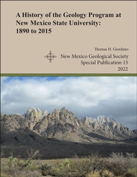
— Thomas H. Giordano, 2022
The history behind the Department of Geological Sciences at New Mexico State University goes back one hundred and thirty years and is complex. This history, as told in the pages of this monograph, documents the important details behind the founding of the NMSU geology program and its growth and evolution to 2015. The program's history is conveniently divided into three administrative phases. Phase I comprises the first 55 years, during which the program's activities were managed by one or two regular academic departments of the University. In the Earth Sciences phase, the geology program was administered as a division, along with one or two other divisions in the same department. In its third phase, the geology program became a regular academic department within the College of Arts and Sciences, its current status as the Department of Geological Sciences. Two obvious legacies of NMSU's geology program are the Department of Geological Sciences and the geophysics program in the Department of Physics. However, the program's legacy is also reflected in the students who have taken its courses and the program's research output through the efforts of its faculty, graduate students, and undergraduate students. Since the mid-1960s, the geology program has produced a vast amount of research that has led to a sophisticated understanding of the geology of southern New Mexico and adjacent areas. Finally, through a better understanding of the geology program's academic evolution, the program's alumni and current students, faculty, and staff will have a more profound appreciation of their academic experience at New Mexico State University
Note:
This publication can be downloaded for free or can be purchased as an on-demand printed book.
NMGS, 45 pages
ISBN: 1-58546-114-8
https://doi.org/10.56577/SP-15
Softcover:
$20.00
Buy
Now
more details...
Geologic Map-79 — Geologic Map of the Valles Caldera, Jemez Mountains, New Mexico
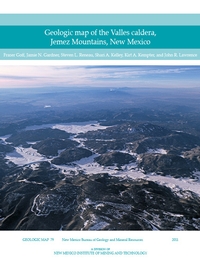
— Fraser Goff, Jamie N. Gardner, Steven L. Reneau, Shari A. Kelley, Kirt A. Kempter, and J. Lawrence, 2011
The Valles caldera, located in the heart of the Jemez Mountains in north-central New Mexico, is the world’s premier example of a resurgent caldera, a giant circular volcano with an uplifted central floor and a near-perfect ring of roughly 15 postcaldera lava dome and flow eruptions.
This new Valles caldera map and cross sections represent the cumulative research efforts of countless geologists over the past 40 years, and several state and federal agencies. GM–79 compiles detailed geologic mapping completed in the past eight years from parts of the nine 7.5–min USGS topographic quadrangles that encompass the caldera. More than 150 map units are described in detail. Also incorporated are new geochronologic data and recent refinements to nomenclature.
Available folded or rolled (additional charge of $5.00 for rolled).
$18.95 plus $6.50 for shipping and handling and 5% gross receipts tax for NM residents.
There is also a bandana and puzzle version of this geologic map available.
ISBN: 9781883905293
https://doi.org/10.58799/GM-79
$18.95
Buy
Now
more details...
One folded sheet + 30 page booklet
Also available as a free download.