


Geologic Map Quadrangles
We are a research and service division of:
(more information)
The USGS topographic quadrangles come in a variety of scales from 1:500,000 to larger scales (i.e. 1:24,000 scale). Each scale may be an appropriate base map for a geologic map, but the scale of map base used should be appropriate to the detail provided in a geologic map. For instance, detailed geologic mapping should not be displayed on a regional scale topographic base (not ideal) and likewise, regional scale geologic map data should not be displayed on larger scale topographic bases (a gross misrepresentation of the detail of the geologic mapping).
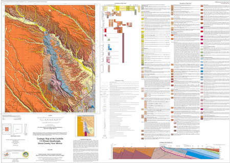
USGS 1:24,000 scale topographic maps are an excellent base for creating detailed geologic maps. They are a convenient size and allow detailed portrayal of complex geology and have long been the standard base for geologic maps. Geologic maps of larger areas, like our state geologic map, are often derived from these more-detailed products.
We have several series of geologic map products at this scale, from both the Bureau of Geology and from the USGS. Many of these maps are available both as printed maps and as free PDF files. Digital map files (GIS products) are available for some maps.
See: 'What is a geologic map and what are they used for?' for a discussion of geologic maps. Our geologic map search page can help you find particular maps.